This is documentation for the next version of Loki. For the latest stable release, go to the latest version.
geoip
The geoip stage is a parsing stage that reads an ip address and populates the labelset with geoip fields. Maxmind’s GeoIP2 database is used for the lookup.
Populated fields for City db:
- geoip_city_name
- geoip_country_name
- geoip_continent_name
- geoip_continent_code
- geoip_location_latitude
- geoip_location_longitude
- geoip_postal_code
- geoip_timezone
- geoip_subdivision_name
- geoip_subdivision_code
Populated fields for ASN (Autonomous System Number) db:
- geoip_autonomous_system_number
- geoip_autonomous_system_organization
Schema
geoip:
  # Path to the Maxmind DB file
  [db: <string>]

  # IP from extracted data to parse.
  [source: <string>]

  # Maxmind DB type. Allowed values are "city", "asn"
  [db_type: <string>]
GeoIP with City database example
For the given pipeline
- regex:
    expression: "^(?P<ip>\S+) .*"
- geoip:
    db: "/path/to/GeoIP2-City.mmdb"
    source: "ip"
    db_type: "city"
And the log line:
"34.120.177.193 - "POST /loki/api/push/ HTTP/1.1" 200 932 "-" "Mozilla/5.0 (Windows; U; Windows NT 5.1; de; rv:1.9.1.7) Gecko/20091221 Firefox/3.5.7 GTB6"The regex stage parses the log line and ip is extracted. Then the extracted ip value is given as source to geoip stage. The geoip stage performs a lookup on the ip and populates the following labels:
geoip_city_name:Kansas Citygeoip_country_name:United Statesgeoip_continent_name:North Americageoip_continent_code:NAgeoip_location_latitude:"39.1027geoip_location_longitude:-94.5778geoip_postal_code:64184geoip_timezone:America/Chicagogeoip_subdivision_name:Missourigeoip_subdivision_code:MO
If only a subset of these labels are required, you can chain the above pipeline with the labeldrop or labelallow stage.
labelallow example
- regex:
    expression: "^(?P<ip>\S+) .*"
- geoip:
    db: "/path/to/GeoCity.mmdb"
    source: "ip"
    db_type: "city"
- labelallow:
  - geoip_city_name
  - geoip_country_name
  - geoip_location_latitude
  - geoip_location_longitude
Only the labels listed under labelallow will be sent to Loki.
labeldrop example
- regex:
    expression: "^(?P<ip>\S+) .*"
- geoip:
    db: "/path/to/GeoCity.mmdb"
    source: "ip"
    db_type: "city"
- labeldrop:
  - geoip_postal_code
  - geoip_subdivision_code
All the labels except the ones listed under labeldrop will be sent to Loki.
GeoIP with ASN (Autonomous System Number) database example
- regex:
    expression: "^(?P<ip>\S+) .*"
- geoip:
    db: "/path/to/GeoIP2-ASN.mmdb"
    source: "ip"
    db_type: "asn"
And the log line:
"34.120.177.193 - "POST /loki/api/push/ HTTP/1.1" 200 932 "-" "Mozilla/5.0 (Windows; U; Windows NT 5.1; de; rv:1.9.1.7) Gecko/20091221 Firefox/3.5.7 GTB6"The regex stage parses the log line and ip is extracted. Then the extracted ip value is given as source to geoip stage. The geoip stage performs a lookup on the ip and populates the following labels:
geoip_autonomous_system_number:396982geoip_autonomous_system_organization:GOOGLE-CLOUD-PLATFORM
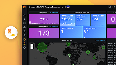
For more information and real life example, see Protect PII and add geolocation data: Monitoring legacy systems with Grafana which has real-life examples on how to infuse dashboards with geo-location data.
Was this page helpful?
Related resources from Grafana Labs